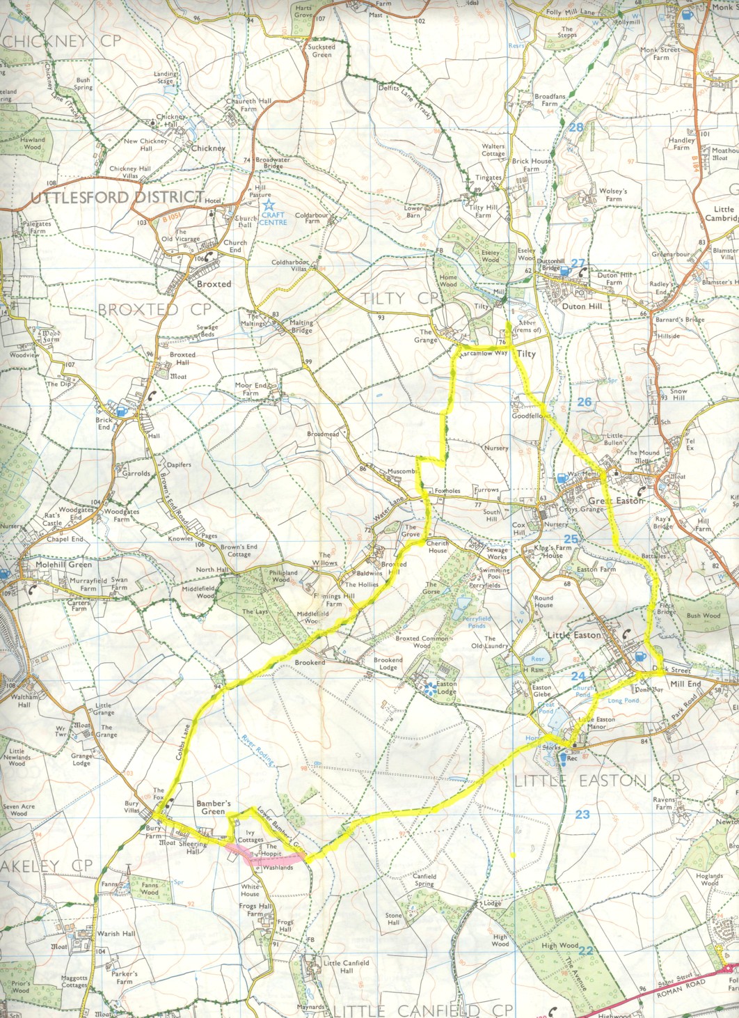
Tilty and the Eastons
Description: A walk around countryside near Great Dunmow, an ancient "flitch town".
The area is generally known as the "five parishes". These are Broxted, Chickney, Tilty, Great and Little Easton. We'll see three of these parish churches along the way.
The walking is generally easy, but there can be some muddy areas, even some time after rainstorms!
Some parts of the walk go across land which would be lost to Stansted airport, if it were ever expanded. Visit this site to learn more.
OS Ref: TL600264
Length: 7 Miles approx.
Approximate time: 3-3½ hours.
Parking: Parking in grounds adjacent to church at Tilty (end of lane.)
Refreshments: Pub at Great Easton.
The Walk
Start by walking in a southerly direction from the church. Turn right at a road, continue for 350m, then at a footpath signpost turn left. Walk gently downhill, then up. At the crest of this gentle hill, go diagonally right to walk along the left edge of a field, with a ditch to the left. Go gently downhill, then turn right just before the end of a small power line. Continue for about 300m, turning left at a waymarker. Keep ahead, cross a road going slightly left then negotiate a stile, to follow a signpost the other side.
Follow the track you are on to a gate. Go through it then aim for the right hand side of an enclosure. Skirt around the enclosure to go through another gate. Keep ahead, along the left edge of a field to another road. Turn right at this road (but before you go too far, peep left to see the best trimmed hedge in Essex!!)
Keep along the road for about 700m coming to a sharp right turn. Go straight on here to walk along a bridleway. Follow the bridleway (which can sometimes be muddy,) firstly though an enclosed section. Cross a lane and carry on to come to an open part of the bridleway. Keep ahead, soon coming to another enclosed section. Cross the river Roding to carry on in the same direction.
The way soon opens up and the bridleway follows the left edge of a field. Keep ahead to come to a house on the right with a tennis court in the garden. At a road turn left. This is Bambers Green, and the whole area around here could be engulfed if Stansted airport is enlarged. Visit http://www.stopstanstedexpansion.com for more details.
Carry on along the road for about 650m. When you are level with a house named "The Willows"on the left, turn left to walk down a drive. Follow the bridleway sign (hard to see from the road, hence the previous instruction!)
At "park view" bear left to follow the bridleway. Further along, this can be very boggy sometimes. In these conditions, it may be prudent to retrace your steps back to the road, turn left, then left at the footpath sign (see map for details, it's the pink route!)
Keep ahead (if it's not been too boggy). Ignore the footpath to the left, but turn left at a bridleway signpost to walk across the middle of a field. This can be waterlogged sometimes, so you may have to walk around any lakes which have formed! Carry on to a concrete bridge, then cross it to enter a recently introduced conservation area. Apparently, there was serious farming here dating back to Roman times. Keep ahead, past two gas pipeline markers (definitely not Roman,!) to take the right path in the next field.
The next part of the walk is pretty straightforward, and can be a real joy in the summer. Keep ahead across the next four fields, crossing various paths of an old airfield, to come to a fence on the outskirts of Little Easton. Go past a pond to the right, then turn right onto a road.
Follow the road to the church at Little Easton. This 12 century church is well worth a visit, and has some old wall paintings, and two splendid recent windows.
The walk continues by going past the left side of the church, through a curved iron gate to the right of the main one, to enter the courtyard of Little Easton Manor. There are gardens to the left with some marvellous hedge topiary. Carry on the short distance to some wooden gates. Go through them to walk along a well mown path.
Keep ahead to walk between some ponds, turning right just after to walk along the right edge of a private garden. At a fence with a gate, go to the right along an enclosed path. After a short while, the path becomes quite narrow as it threads around some "back gardens". On arriving at a road (Duck Street) turn right. Follow the road for about 200m before turning left at a footpath signpost. Skirt along the right edge of some common grounds (sometimes with horse jumping fences on it.) Make your way to the far right corner of the ground to pick up a footpath at a waymarker. This can sometimes be overgrown and awkward to find. Once found, it can be hard to negotiate for a short while (especially if you're wearing shorts as you'll be a bit stung by nettles!)
Carry on until a bridge on the right, cross it to follow a path diagonally to the left. Great Easton church is visible in the distance. Soon, there is another bridge to cross. Keep to the right of the next field, soon looking out for yet another bridge on the right. Cross it then turn left immediately to follow the other side of a river (Chelmer.) Eventually follow the footpath away from the river temporarily, to cross a stile in the middle of the far field boundary.
Take the path ahead (path no. 19) to walk along the left edge of a field. Depending on the season, and the type of crop growing, it can be a bit overgrown for a short way. After a short distance, we'll rejoin the riverside route for a short while.
Follow the river until just before a power line, then turn right along a footpath. Follow to a waymarker by a plank bridge. Cross it and keep ahead to another bridge which we'll also cross. Turn right to follow the right edge of this field, turning left soon at its corner. Carry on to walk between houses to come into Great Easton.
The walk continues by crossing the road in front of the church and memorial to pick up a footpath opposite (marked no. 5.) Follow this between more houses, shortly coming to a stile. Cross it then walk across a field, soon to see a white tipped marker informing you of the location of another stile. Cross this to carry on in the same direction gently downhill.
Keep ahead to cross a wooden bridge, crossing the field after to come to a concrete bridge. Cross it, walk across a meadow in the same direction to cross a stile on the far side to come to a road. Turn right, then soon after, just after a Goodfellows Farm sign, follow a footpath signpost to walk diagonally across another meadow.
Go through a hedge gap to follow a path along a field boundary. After a few paces, the small cupola of Tilty church comes into view, signifying the end of the walk. A bit further on, the spire of Thaxted church can be seen slightly to the right, on a fine day.
Keep ahead, crossing a road to retrace your initial steps, back to your motor.
Click here to get an OS map with the route highlighted
Click here for a "companion photo gallery" for the walk.
|
|